Showing posts with label exercise. Show all posts

montcalm point.

summer is here and it's getting off to a proper, humid start. the cats are splayed akimbo all over the floor. you know it's pretty extreme if the felines are uncomfortable with the heat.

first day of summer hike!adam and i went on a hike with the dog to kick off the longest day of the year. we chose to trek the northwest bay trail in the tongue mountain range. it's a significant 10.8 miles round trip but it's mostly flat. there are some sporadic climbs and descents when going over hills and ridges but the trail follows the shore of lake george so it's easy to overlook the exertion.

hike to montcalm point

we stopped and started along the way to let the dog swim and to snap some photos. despite the fact that the trail is so close to the water and the recent amount of rain, the trail was muddy in limited areas. it took us a little over two hours to get to montcalm point from the clay meadow trailhead, passing multiple possible campsites along the waters edge.
a quick swim was a great reward upon arriving at the southern most tip of the tongue mountain range!

montcalm point - tongue mountain range - lake george

short but steep.

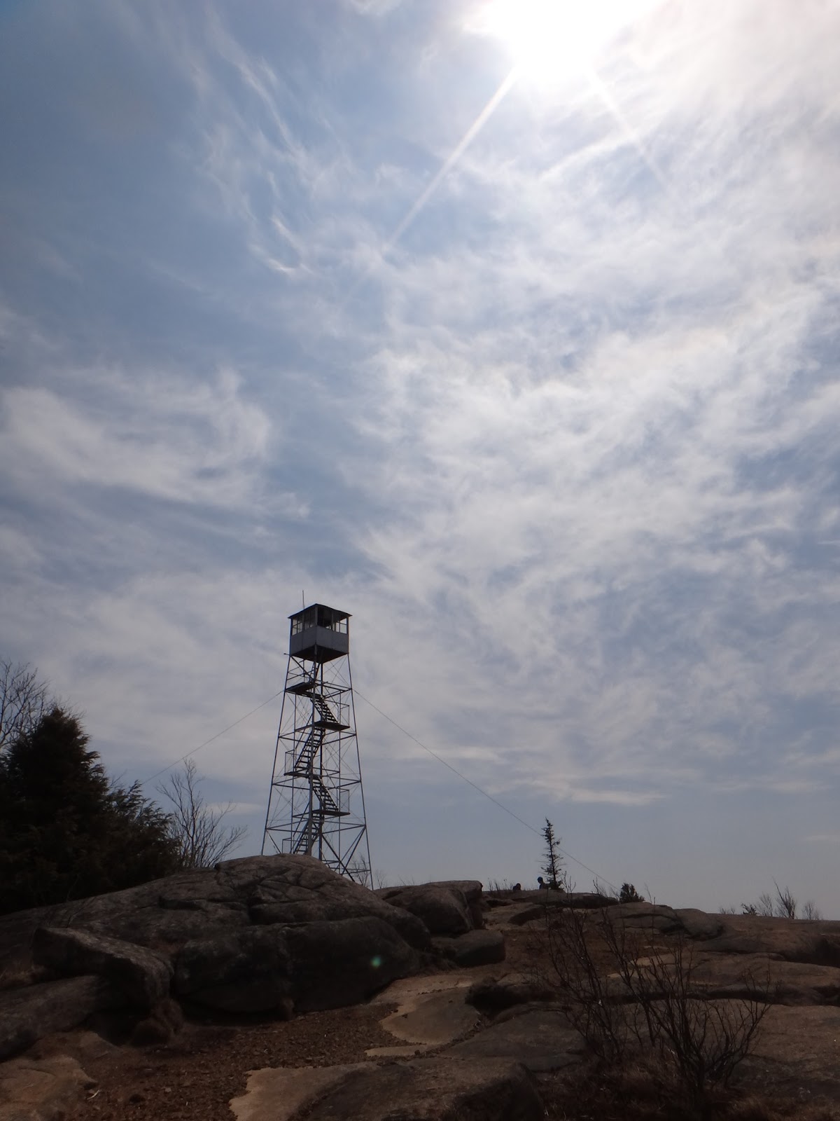
oh, hadley mountain...your short distance betrays your difficulty. 1,525 feet of elevation gain in 1.8 miles? i won't hold it against you though-you big lump of rock-because it's all worth it in the end.
.
.
.
.

(more pictures here)

the first painting of the new year.

tenzin

'tis the season for resolutions, no?
i don't generally make any formal goals for the new year but i can say that i have a bit of work to do to recover from a brief stint of unhealthy lifestyle habits. it's amazing how quickly our bodies can fall out of shape from neglect and over indulgence.
the little beauty above happens to be my first quick painting of the new year. she's on her way into the mail to a friend on the west coast.

fifth peak.

fifth peak
saturday was a picture perfect autumn day; crisp temperatures and cerulean skies. it was much too perfect to waste a work out at the gym; especially when there are dozens of mountains to hike within 45 minutes drive.

fifth peak
going north through the super charming town of bolton landing, we chose to summit fifth peak, one of the many summits included in the tongue mountain range on the east shore of lake george. there are supposed to be timber rattlesnakes in the tongue mountain range, but i have never seen one. i'm not sure if this makes me lucky or not.

fifth peak
from the clay meadows trailhead, the summit of fifth peak is about five miles round trip. unfortunately, there is an incorrect trail sign about a quarter mile in from the trailhead that suggests the full trip to fifth peak is over 10 miles.

fifth peak
the short but steep climb is through some of the most beautiful woods in the adirondacks. the summit has open, grassy areas where multiple vistas can be seen. there's even a (slightly beaten down) leanto at the top. it would certainly make a great campsite despite the fact you would need to carry in all of your water.

(more photos here)

sawteeth mountain.

sawteeth mountain
what better way to celebrate your one year wedding anniversary than to hike 14 miles and summit a high peak?
we started from the st hubert's parking area at the ausable club at 8:45, signed in at the amr gate and began walking the lake road. i hate to say it, but there is little interest to this road after the first time you walk it. we arrived at the dam around 10:00 and were glad to start hiking an actual trail. taking the trail beside rainbow falls up, we reached the summit around noon. it was windy and quite cold up top but offered a fine view of the great range.
sawteeth mountain
15 minutes later, with frozen fingers and full bellies we began the descent to ausable lake via the scenic trail. this is a steeper trail and added almost a mile to the trip. there were many lookout points perched on the cliffside scramble down offering views to the southeast that weren't available from the summit. the final portion of the scenic trail that follows the lakeshore was a rugged crawl over glacial erratics. it took us nearly three hours to descend from the summit back to the dam.
sawteeth mountain
the mind-numbing walk of the lake road followed and we were back at the car by 4:45, making it an even 8 hour day.
(more photos here.)

successful none the less.

perhaps it was the amount of time since our last backpack. perhaps it was the declining frequency of our gym visits. perhaps it was an over ambitious plan. perhaps it is the nature of aging. i don't recall when post-trip expectation switched from muscle aches to joint pain.

warning signs at upper works trailheadregardless, our backpacking trip was shortened by one day and one mountain peak. (poor skylight, we just keep shirking you! this time it was due to a trail-less behemoth named allen mountain-trip report to follow in a separate post).
we started from the upper works trailhead outside of newcomb on independence day. it's the first time we have hiked this trail in a few years and the re-routing caused by hurricane irene is obvious. the calamity brook trail, some of which is newly cut, now follows the north side of the brook for the beginning portion. one of my favorite suspension bridges was washed away. i feel fortunate to have gotten some pictures of it to refer back to.
we headed for a campsite off of flowed lands that is new to us and a bit out of the way. it turns out that the livingston point campsite was the highlight of the trip. livingston point is on the east shore of flowed lands, 0.6 miles from the junction of the calamity brook and hanging spear falls trails. it initially climbs up above flowed lands only to descend back to water level. it seemed clear that the trail and the camping areas saw much less use than other sites in the vicinity.

orange hawkweed at the campsitejust prior to arriving at the camp area, we passed a fresh pile of bear scat in the trail. it seems this was nature's foreshadowing as that bear, apparently a mama with three cubs, visited our bear-proof food canisters early on the second morning of our adventure. our food was safe but our neighbors across flowed lands were not so lucky. we heard them banging pots and calling, 'hey bear' for quite some time around dusk. crossing paths with a DEC officer on the trail out, we learned that that group had left juice and cooking dishes out, a big no-no in the eastern high peaks.

livingston point on flowed landswe chose to take the campsite rather than the leanto due to its proximity to the water and also because of the view. much of the time not on the trail was spent staring out over flowed lands towards mt marshall, iroquois peak, algonquin and mt colden. there was orange hawkweed growing throughout the campsite. we were visited by all types of birds and a brave little chipmunk. there were also tons of little, tiny baby frogs hopping around.

Untitledno one else came through the livingston point camps the entire time we were there and the leanto remained vacant. we enjoyed two nights without the need for a rainfly, caught the sunset and saw the stars.
despite the aching hips and knees, we covered 27 miles and had one of the most memorable adirondack backpacks in recent memory.

colvin & blake.

i am not in the habit of skirting the truth or fibbing to you here on this blog. it is because of that fact i will honestly tell you that i am more sore right now than i have been post-hike in quite some time. to put it bluntly, mt colvin and blake peak kicked my ass.
i am sure there are high peak warriors that will snuff at this and the fact that it took us 10 hours to cover the 14-point-something miles round trip. adam and i are in pretty decent shape. we go to the gym (fairly) regular. although it is entirely true that gym-shape does not equal trail-shape, we were not unprepared for this trek.
it was a beautiful day, clear and sunny. there was only one couple we passed on the same route as us which is highly unusual in the high peaks. we saw multiple deer and they were not afraid of us.
great range and lower ausable lake from mt colvin
(view of lower ausable lake from the summit of mt colvin. note the black fly top center)

we also hiked two mountains. we hiked mt colvin twice actually because you have to backtrack the way you came to get back to the trailhead.
i think it was the col between mt colvin and blake peak that wiped me out. the colvin side was pretty steep with two ladders positioned along the way. i fell/slid at one point, scraping up the side of my right arm. slick mud and steep descents don't mix, especially on tired jello legs with black flies dive bombing your eyes and ears.
(me descending into the col between colvin and blake. *photo by adam)

the summit of mt colvin was gorgeous with amazing views of the entire great range and giant mountain. the summit of blake peak was...well...unremarkable. it is entirely shrouded in scrub trees. there isn't even much of a marker to give you the comfort that you FINALLY made it. granted, i was so wiped out when we summited blake that i couldn't care less about views. i wanted to sit, get out of the beating sun, not hear incessant fly buzzing and gather the mental and physical energy to hike the 7+ miles back out.
on the summit of blake peak...completely exhausted
(me entirely exhausted on the summit of blake peak. *photo by adam)

high peaks completed as of june 15th, 2012 = 41